File:Internet map.jpg
Original file (1,280 × 1,280 pixels, file size: 1.27 MB, MIME type: image/jpeg)
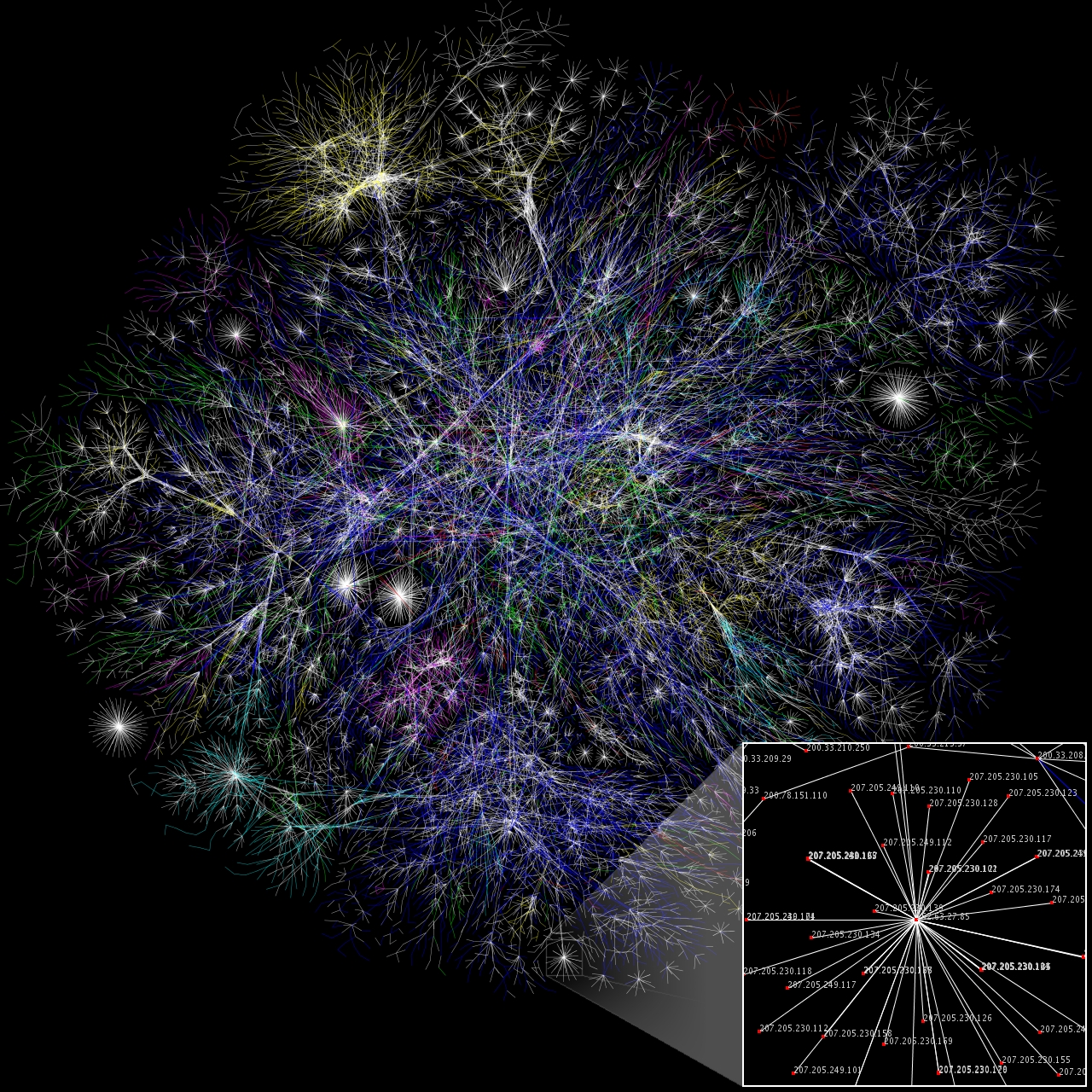
The Wikipedia user Wikipedia:User:Matt Britt created this small partial map of the Internet from the 2005-01-15 data found here using a slightly different rendering technique than was used to generate the maps there. Each line is drawn between two nodes, representing two IP addresses. The length of the lines are indicative of the delay between those two nodes. This graph represents less than 30% of the Class C networks reachable by the data collection program in early 2005. Lines are color-coded according to their corresponding RFC 1918 allocation as follows:
- Dark blue: net, ca, us
- Green: com, org
- Red: mil, gov, edu
- Yellow: jp, cn, tw, au, de
- Magenta: uk, it, pl, fr
- Blue-green: br, kr, nl
- White: unknown
HUGE 4096*4096 (probably unusable in articles) version can be found at Wikipedia:Image:Internet map 4096.png.
Source: http://en.wikipedia.org/wiki/Image:Internet_map_1024.jpg
Author: Wikipedia:User:Matt Britt
Permission: This image is availlable under the Creative Commons Attribution 2.5 license.
File history
Click on a date/time to view the file as it appeared at that time.
| Date/Time | Thumbnail | Dimensions | User | Comment | |
|---|---|---|---|---|---|
| current | 18:02, 1 November 2007 | | 1,280 × 1,280 (1.27 MB) | MauroB (talk | contribs) | The Wikipedia user Wikipedia:User:Matt Britt created this small partial map of the Internet from the 2005-01-15 data found [http://www.opte.org/maps/ here] using a slightly different rendering technique than was used to generate the maps there. E |
You cannot overwrite this file.
File usage
The following 4 pages use this file: